 |
 |
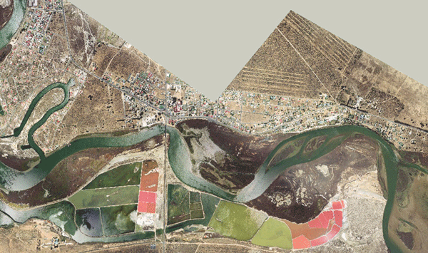
As part of the environmental impact analysis (managed by Anchor Environmental Consultants and the Department of Water Affairs (SA)) for the Berg River estuary due to the construction of the Skuifraam Dam in the Stellenbosch region, we have been appointed to conduct topographic survey of the region.
Photogrammetric mapping has been completed using 1:10,000 scale colour aerial photography carried out in January 2003.
We are now in the process of intergrating bathometric survey data for the river bed channel, as supplied by Tritan Survey, into the digital terrain model (DTM). This process requires the development of customised software for the interpolation of the surveyed river cross-section and mid-stream data.
Map production is being done with the use of the following mapping software:
|
|
|