 |
 |
In order to carry out hydrological modelling of a test section of the Molenaars River bed (near Du Toits Kloof - Western Cape), AfriMap GIS was commissioned to carry out an aerial survey. The test area is some 60m in length and up to 30m wide in places.
Aerial photography was done using a Canon EOS D60 digital camera equipped with a fixed focal length lens (50mm focal length) from a helicopter platform (JetRanger) at a height of 60m above the river bed surface.
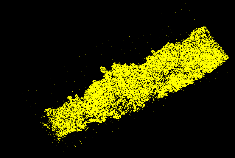
Camera calibration and aerial triangulation were carried out using the close-range photogrametry software IMetric on the entire data set. The digital terrain model (DTM) was calculated with the use of in-house image matching software, with a total in excess of 170,000 terrain points produced for the river bed section under investigation:

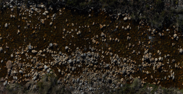
The production of digital ortho-rectified imagery of the river bed was completed using in-house developed ortho-rectification software:
|
|
|