 |
 |
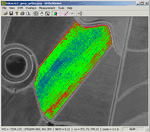
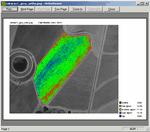
Orthoviewer was designed to allow for an easy viewing and image manipulation tool for digital multispectral orthophotos, for use in precision agriculture, although it can also be used as a simple digital orthophoto viewer.
We currently support Uncompressed TIFF and PNG file formats.
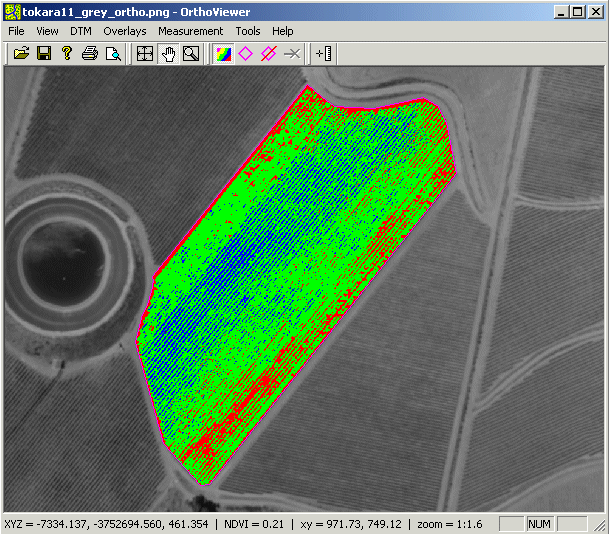
When a digital terrain model (DTM) is available, it can be imported to allow for the display of height information as well as the position. There is also a handy polygon tool for defining the image region to be analysed (for example a specific vineyard block), as well as a distance measuring tool.
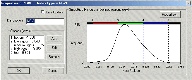
Multispectral image analysis (image indices) and classification are easily done with the use of interactive graphical dialog boxes.
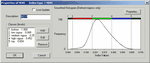
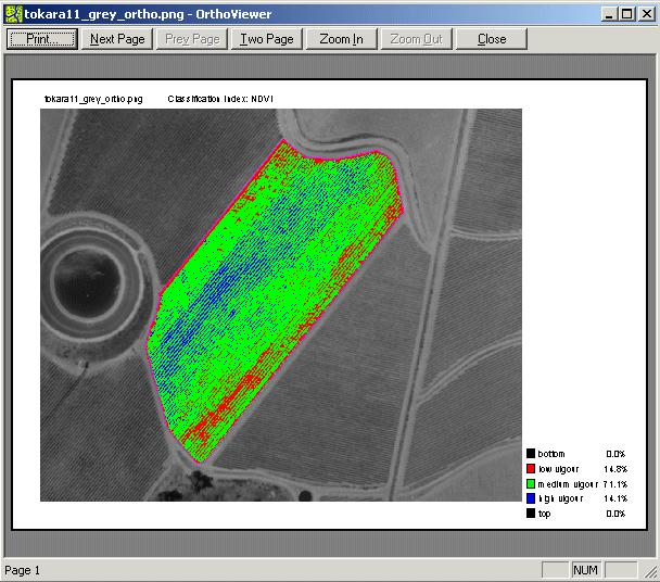
Once the user is satisfied with the classification scheme the results can be sent directly to the system printer, stored as output TIFF image files or stored in project configuration files.
We are still planning additional developments, including vector data support (for ESRI SHP and DXF files) and contour generation.
A limited version of orthoviewer is supplied to clients free of charge with mapping work done by AfriMap GIS. Equiries about the purchase price and sale of the full version of
orthoviewer can be sent via e-mail to: info@afrimapgis.co.za
For help with orthoviewer follow the link OrthoViewer Help
|
|
|